
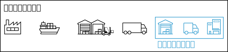
ラストワンマイル
様々な環境や条件下で確実にナビゲーションできる自律移動ロボットを開発することで,物流の「ラストワンマイル」を自動化する技術開発を目指す.従来のデータ(レンジデータやRGB画像)と不可視データ(磁気や信号強度)を用いた,混雑環境でもロバストな自律ナビゲーションの開発を機軸とする.
Our aim is to automate the “last-one-mile” delivery step in the supply chain by developing autonomous mobile robots that can reliably navigate across diverse environments and conditions. Our focus is on the development of robust autonomous navigation even in crowded environments by using both, conventional data (range data and RGB images), as well as invisible data (magnetic and signal intensity).
Multi-Navigation
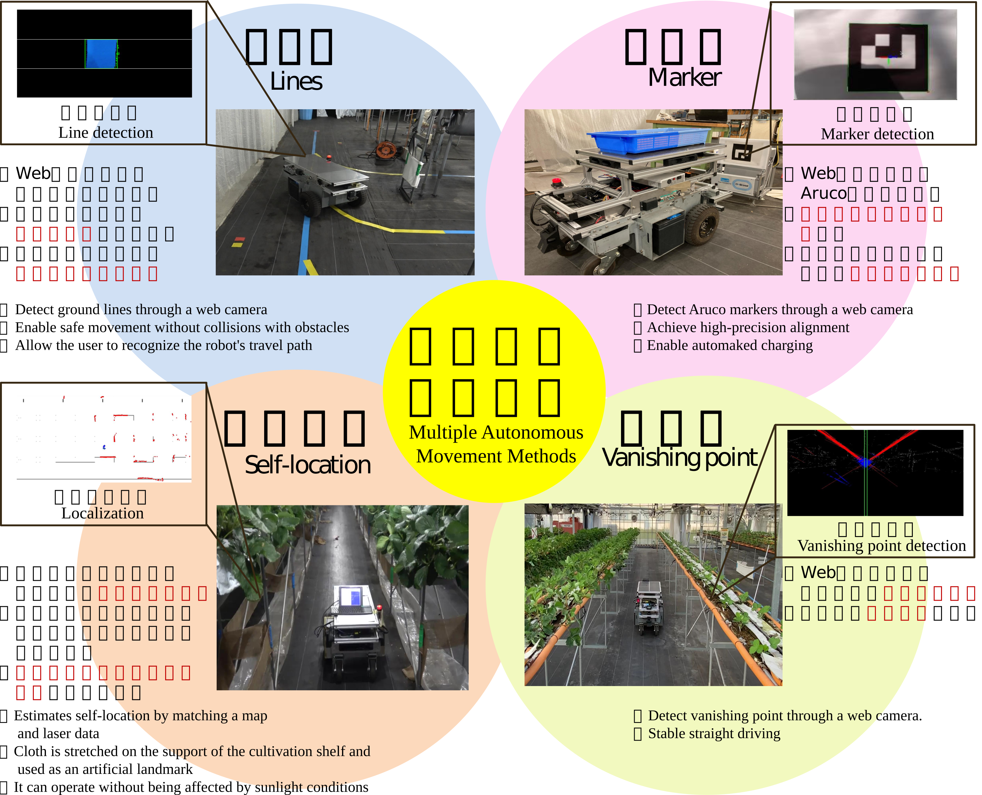
研究室では,マルチナビゲータという手法に基づいて,自律移動技術の開発を行っている.マルチナビゲータは、複数の走行制御プログラム(ナビゲータ)を同時に行う.それぞれのナビゲータは,ロボットの制御量と優先度の算出を行い,優先度が高いナビゲータに基づいてロボットの制御を行う.この手法により,高精度で複雑な走行制御の実現が可能となる.以下に本研究室で開発しているナビゲータの一部を紹介する.
In our laboratory, we are developing autonomous mobility technology based on a method called multi-navigation. Where, multiple driving control programs (navigators) are executed simultaneously. Each navigator calculates control commands and its own priority, and the command of the robot with the highest priority is executed. This method makes it possible to realize highly accurate and complex driving control. Some of the navigators being developed in our laboratory are described below.
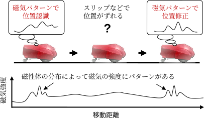
Magnetic Localization
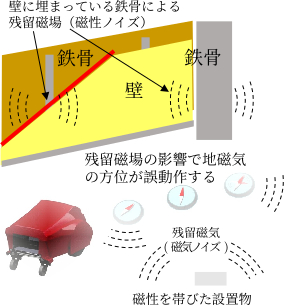
磁気ナビゲーション法の基本的なアイディア
Magnetic Navigation
身の回りには着磁した構造物(残留磁場)があふれている⇒電子コンパスでは方位制御できない.磁気を取り除くのは現実的に難しい⇒ならばそれを目印に(逆転の発想!)
There are many magnetized structures (residual magnetic fields) around us so magnetic direction (compass) is not accurate enough. As it is difficult to remove magnetism, instead we opt to use it as a landmark (reversal idea!)
WiFi Localization
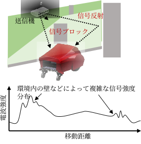
WiFiナビ法の基本的なアイディア
Wireless signal strength navigation
電波強度は、送信機から距離(遠いほど弱い)だけでなく、壁などが信号をブロック・反射によっても変化する. 本アイディアはすべての現象を考慮した信号強度地図を作成することでナビゲーションを実現できる.

Signal strength changes depending on the distance from the transmitter (the farther, the weaker), and due to walls blocking or reflecting the signal.
By creating detailed signal strength maps that takes into account all phenomena, higher self-localization accuracy can be achieved.
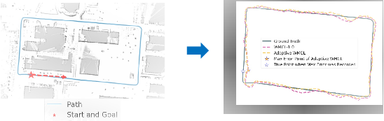
Visual Localization
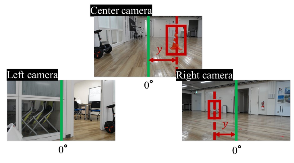
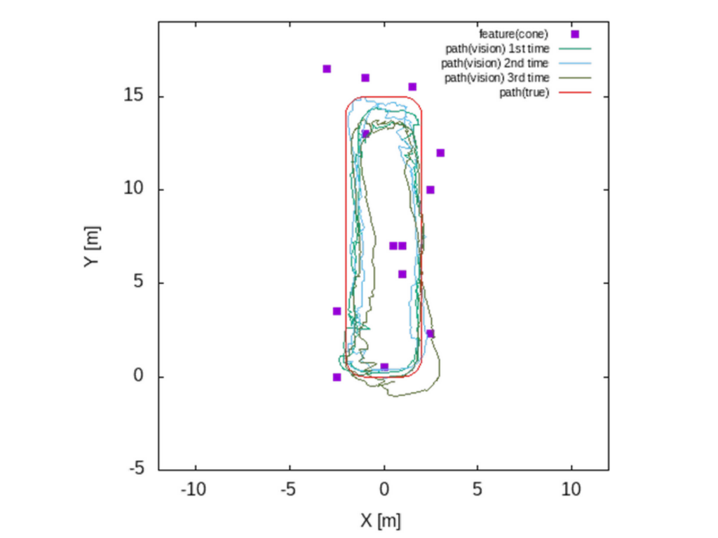
物体認識の進歩を利用して,ロボットの自己位置推定に,物体認識アルゴリズムを実行するカメラと環境地図(フロアマップなど)を使用することが可能である.少ない物体数でも自律航行に十分な精度が得られることを示す.
Taking advantage of advances in object recognition, it is possible to use general objects as landmarks to estimate the robot’s self-position. The results show that sufficient accuracy for autonomous navigation can be achieved even with a small number of objects.
Visual Navigation
セマンティック セグメンテーション(画像をピクセル単位での分類) を使用することで、特定の地形のみを通過するようにトレーニングできるインテリジェント ナビゲーション システムを構築できます。 当ロボットはキャンパス内の道路のみを使用し、草地や潜在的な障害物を避けるように訓練されています。
By using semantic segmentation (classifying images pixel by pixel), you can build intelligent navigation systems that can be trained to traverse only specific terrain. Our robots are trained to use only campus roads and avoid grassy areas and potential obstacles.